Formulaire de recherche
Nombre de résultats: 9797
Trier par:
-
Iraq - March 2009
document-
 Télécharger
 Détails
- 1.16 MB
- Download Count: 565
Map in Adobe Acrobat format related to a UNHCR operationDate de publication: 20 July 2020 (5 years ago)
Créé: 18 February 2011 (14 years ago) -
-

Southern Caucasus - January 2006
document-
Télécharger
Détails
- 897.58 KB
- Download Count: 551
Map in Adobe Acrobat format related to a UNHCR operationDate de publication: 20 July 2020 (5 years ago)
Créé: 18 February 2011 (14 years ago) -
-

Bulgaria - UNHCR Presence and Asylum system facilities - 14 November 2016
document-
Télécharger
Détails
- 555.52 KB
- Download Count: 552
Bulgaria - UNHCR Presence and Asylum system facilities - 14 November 2016Date de publication: 20 July 2020 (5 years ago)
Créé: 14 November 2016 (9 years ago) -
-

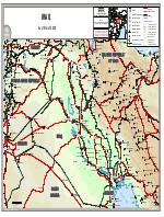
Jordan - Reference map - 29 July 2019
document-
Télécharger
Détails
- 462.64 KB
- Download Count: 790
Jordan - Reference map - 29 July 2019Date de publication: 20 July 2020 (5 years ago)
Créé: 29 July 2019 (6 years ago) -
-

Sierra Leone Atlas Map - April 2007
document-
Télécharger
Détails
- 379.38 KB
- Download Count: 785
Map in Adobe Acrobat format related to a UNHCR operationDate de publication: 20 July 2020 (5 years ago)
Créé: 18 February 2011 (14 years ago) -
-
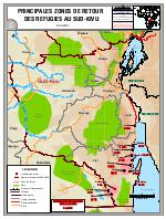
Principales zones de retour des refugies au Sud-Kivu - 5 Mai 2009
document-
Télécharger
Détails
- 539.97 KB
- Download Count: 672
Map in Adobe Acrobat format related to a UNHCR operationDate de publication: 20 July 2020 (5 years ago)
Créé: 18 February 2011 (14 years ago) -
-

Liberia Operation - Liberia _ C?te d'Ivoire border - 12 February 2011
document-
Télécharger
Détails
- 1.28 MB
- Download Count: 748
Map in Adobe Acrobat format related to a UNHCR operationDate de publication: 20 July 2020 (5 years ago)
Créé: 3 March 2011 (14 years ago) -
-
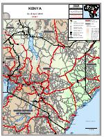
Kenya- April 2008
document-
Télécharger
Détails
- 839.82 KB
- Download Count: 511
Map in Adobe Acrobat format related to a UNHCR operationDate de publication: 20 July 2020 (5 years ago)
Créé: 18 February 2011 (14 years ago) -
-

Mozambique - Febrauary 2013
document-
Télécharger
Détails
- 799.79 KB
- Download Count: 777
Map in Adobe Acrobat format related to a UNHCR operationDate de publication: 20 July 2020 (5 years ago)
Créé: 2 April 2013 (12 years ago) -
-

Registered Refugee Camps Populations, Easetrn Chad - 29 February 2008
document-
Télécharger
Détails
- 300.76 KB
- Download Count: 678
Map in Adobe Acrobat format related to a UNHCR operationDate de publication: 20 July 2020 (5 years ago)
Créé: 18 February 2011 (14 years ago) -