Lebanon (DVI) Drought Vulnerability Map 2025
| Type de document: |
Flash Update
|
| Langue(s): |
|
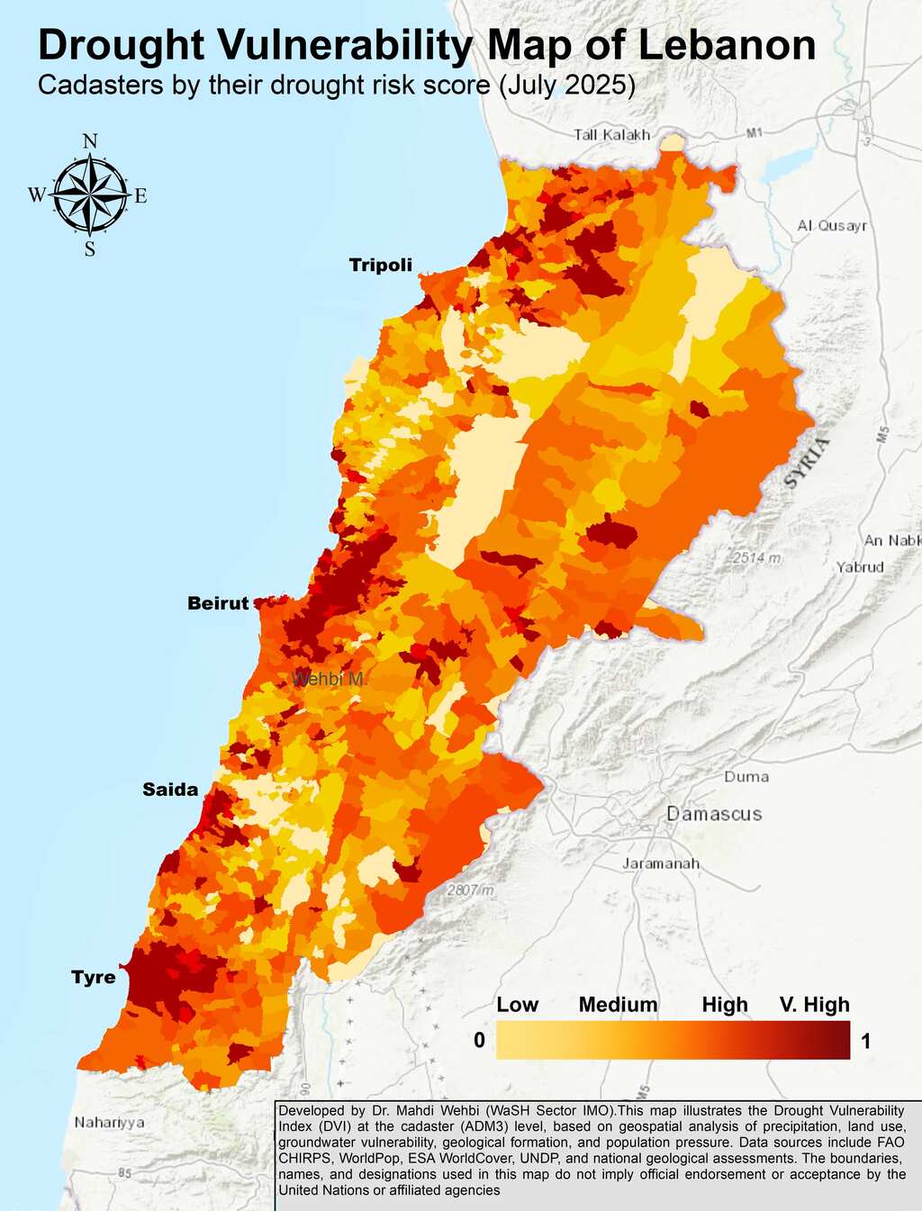
This drought vulnerability map for Lebanon is the outcome of a research-driven and consultative process that integrates geospatial analysis, scientific modeling, and stakeholder input. At its core is the Composite Drought Vulnerability Index (DVI), developed by Dr. Mahdi Wehbi (WaSH Sector IMO) to inform national planning, coordination, and advocacy amid increasing water stress. The DVI was constructed using a Spatial Multi-Criteria Analysis approach, supported by remote sensing, GIS, and globally recognized drought indices such as the SPI/SPEI. It integrates five key indicators, precipitation trends and drought anomalies, groundwater vulnerability (DRASTIC and salinity), land use/land cover, geological (hydrogeological) resilience, and population pressure- reflecting the dimensions of exposure, sensitivity, and adaptive capacity.
Télécharger
(PNG, 9.58 MB)